It’s a weird time in technology and the web. It feels like a couple of big shifts are happening all at once. One of them is a big rise in “enshittification”, most noticeably for me with the death of twitter.
It’s pretty surprising watching twitter die and, I’ll be honest, it’s upsetting. I allowed twitter to become a bigger part of my online life than I should have done, and now it’s going down the toilet in a shift that feels quite sudden, given that I’ve been on twitter for about 16 years. Throughout 2023 I found myself gradually swapping from twitter to mastodon. Admittedly it wasn’t a very deliberate choice. I still go on both, but these days I think about posting to mastodon first and I’ll copy the post into twitter if I can be bothered.
Why is twitter going down the toilet? (I refuse to call it “X” by the way) It took me a while to notice the problems, and maybe it was only the contrast with mastodon that helped me see it more. People talk in dramatic terms about nazis posts, which I never really saw, but there’s a shift in “the algorithm” of the feed. Mastodon only shows stuff from people I follow (and their re-toots). When I first played with mastodon a couple of years ago, it felt similar to twitter, but now twitter has shifted. It’s not even a subtle shift any more. My twitter timeline has very few posts from people I follow. Instead it’s full of clickbait videos and other “engaging” posts from non-followees. A lot of ads too of course.
This algorithm shift is also noticeable with less engagement on my tweets. I see fewer likes and retweets these days. My tweets are hopefully not too dull, but they’re not exactly carefully engineered to “do big numbers”. They’re in a medium-interesting middle-ground which now seems to mean they go ignored more. And, before you roll your eyes at my dreadful narcissism, I know this is not just me. Others have said the same. If you’re guilty of paying attention to how many likes and retweets you get, then you’re probably noticing fewer of them these days. Meanwhile the tweets we do see, from strangers who we’re not following, do often appear to be engineered for engagement. All the click-bait tricks. This includes posing questions where we don’t get to see the answer until we click. Video tweets usually do the same. We see the intriguing freeze-frame. We don’t get to see what happens next until we click.
How twitter made me an angry cyclist
Then there’s the outrageous statements, or the statements which we know to be false and it’s hard to resist replying (or at least clicking to make sure that somebody has set them straight. Invariably hundreds of people already have). Just another kind of click-bait, but I think this one gives rise to the idea that the algorithm is actively evil. The outrageous statements can be on matters which are innocuous yet somehow engaging, but of course it’s also on serious matters of politics, culture wars, nazis versus black-lives-matter etc. I imagine this is where the “twitter is full of nazis now” idea comes from. I think it depends what you engage with. Also I think a lot of people look at what Elon Musk is interested in and maybe extrapolate that as a statement from twitter. But by even looking at that, the algorithm begins to steer you onto these topics.
From my own perspective I really noticed this, not on nazi topics, but on cycling related tweets. I follow quite a few keen cyclists. It’s not a big obsession for me although admittedly it might sound strange to some people if I say that I am sad to no longer be cycle commuting since I started working from home. The algorithm has really pounced on this. It bombards me with videos of cycling road accidents (because I have to click to see what happens!) and people airing rather extreme pro-cycling or anti-cycling opinions. I do click on this stuff. I can feel the result is that twitter is making me angry, to the point where I feel I’m being recruited as foot-soldier in the war between cyclists and motorists. The really bad thing is that I can feel it effecting my psychology and spilling out into the real world. On the rare occasions when I do get on my bike these days, I feel anxious and angry at all the motorists around me, ready to go out and get into a confrontation with somebody. …until I calm down and remember the truth …the reality …the big cycling secret. It feels unfashionable to say it these days because nobody finds it exciting or anger-inducing but the secret is: most other road users are considerate, and the vast majority of cycle journeys, even in central London, are enjoyable and pass without incident. How boring.
You would never get that from my twitter timeline, and this, more than anything, has made me aware of the nature of “the algorithm”. It cuts across all topics of course. In politics I used to think a big problem was the “echo-chamber” effect. But nowadays we’re presented less with our friends agreeing with us, and more with a weird mixture of strangers agreeing with us, plus strangers with unhinged extreme opposite opinions to us. It’s not mild-mannered strangers who vote the other way. It’s people posting short ridiculous caricatures of political opinions. Extra engaging and extra anger-inducing.
Profit-driven enshittification
I think people tend to attribute too much malice to the algorithm. Nobody at twitter sat down and said “how can we make all our users more angry about stuff?”. They just wrote an algorithm driven by clicks. If we engage with something, we get shown more of it. Maybe the anger that emerges from it, is in some sense an expression of human nature.
But of course this algorithm is controlled by twitter, and it’s a shift from what went before. Previously we saw more posts from friends, and fewer ads. But maybe we still attribute too much malice because after all, it’s just about $$$. Blame and outrage is directed at Elon Musk. I’m not here to defend him (the guy’s clearly a bit of a dick, and I wish he would stick to rockets and electric cars) but I can well imagine all that really happened is, he told the twitter staff to take urgent action on profitability. Sort of fair enough I suppose. They already knew about various levers they could pull to make more money. Musk told them to crank the profit levers up to max, and that’s the effect we see. No big nefarious purpose. Just more ads, and more shovelling of engagement fodder posts instead of the (apparently less engaging) posts from our followees.
We call this effect “enshittification” thanks to Cory Doctorow, who writes excellently on the topic. But this ramping up of ads and other money-making patterns has limits. I’m sure the staff at twitter have worried about whether they can get away with pushing the profit levers, the enshittification, up so high. Will users put up with it? It all depends on the degree of lock-in we feel. In this post, Doctorow explains
“An enshittification strategy only succeeds if it is pursued in measured amounts. Even the most locked-in user eventually reaches a breaking-point and walks away, or gets pushed”
“the strong incentives for product managers, executives, and shareholders to enshittify results to the precise threshold at which users are nearly pissed off enough to leave, but not quite”
From my perspective twitter has crossed that threshold. I know plenty of others who (wisely it turns out) had a lower tolerance and left twitter earlier. And in my free-software loving communities such as OpenStreetMap, I know folks who never even touched twitter in the first place (who no doubt read this kind of blog post with a smug sense of “told you so”). Of course quite a few people didn’t leave, but I guess the fact that it lost 72% of its value is strong evidence that Twitter has done something wrong, and that something is “enshittification”.
The word “enshittification” is taking off as a way to describe the place we’re at with a lot of tech at the moment. Actually it seems like a very clumsy word for it. I do prefer Rohan Kumar’s suggestion of “User Domestication”. Like animals which used to run wild and free, but which gradually become dependant on their masters, users are eventually herded into enclosed online experiences where the tech companies can tame us, pacify us and then exploit us.
It’s not a surprise to me that, as a profit-driven company, twitter would start to seek that profit in ways which make things worse for users, or that the lock-in network effect comes to work against us in that circumstance. I was a bit surprised by how dramatically they have yanked on the profit levers to enshittify twitter over a relatively short timespan.
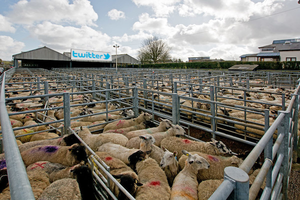
It takes a lot to escape user domestication, but the cattle are bursting out of the twitter enclosure right now and running wild across the prairie. Or at least there’s suddenly a lot of people looking around for alternatives.
Seeking new pastures. The move to mastodon
One way the cattle analogy doesn’t follow, is that there’s no real harm in signing up for other services to try them out. You can join the herd in many new cattle enclosures at once. The only question is whether you allow yourself to become domesticated. For example I have signed up and created my profile on “threads”, the new Facebook/meta twitter alternative, even though this seems like an utterly asinine choice for a new twitter alternative if you think in terms of hoping to avoid future exploitation as a domesticated user. Why on earth would you put down roots on a social network closely tied to Instagram, the very flag-bearer of the engagement algorithms we were trying to get away from? There are alternatives, including some operated by quite small friendly looking tech start-ups. No harm in trying them out, but… there is a better way.
Mastodon is very twitter-like but free and open source software, and decentralised software. A network hosted across many “instances”. I won’t go into the full pitch here, except to say that it’s a smart alternative to the depressing inevitability of enshittification we see on any for-profit hosted service. I recommend it.
However… I think the mastodon community (who seem to do a lot of meta-posting about how wonderful mastodon is) is a bit too self-congratulatory sometimes.
On-boarding of new users is confusing just because you’re immediately faced with this paralysingly important choice: which instance to join? I don’t think it really matters that much, or at least I don’t think it should matter, and people should feel free to post on topics unrelated to the topic focus on their instance (the etiquette is a little unclear but hopefully most folks feel the same). But the choice of instance does matter when it comes to the usual service hosting type questions. It made me laugh when people first started crowing about mastodon saying things like “because we don’t trust twitter with all our micro-blogging content” …the solution is to move to some server our friend’s friend has spun up in their free time? This even pre-dated the ability to migrate accounts between instances, but even with that ability, the reliability of hosting (the idea that my instance might disappear suddenly) is still a worry. Relatedly there’s the question of funding. People donating, or talking about donating, to their mastodon hosts. Coming from the twitter-hosts-millions-of-users-for-free model, this feels a bit fragile, and perhaps unlikely to be able to receive those millions of users.
Many of us moved from twitter and followed eachother initially using tools such as “debirdify” or “fedifinder” to slurp our follow-lists from twitter (This is based on mentioning your mastodon account in your twitter profile, so be sure to do that) This was a good little cheat that meant mastodon didn’t really need to build the community from scratch. Even so, it’s obviously a sub-set of my twitter followees who have made this move. To me it feels like a more tech-savvy sub-set. Mastodon is like in the early days of twitter. That’s nice in a geeky clique sort of way. Mastodon enthusiasts will say we don’t want to attract all of twitter onto the platform. But I would like my less tech savvy friends to be on there, and to me the mastodon experiment hasn’t really succeeded unless/until it can go mainstream enough for that to happen.
Decentralisation offers a lot of solutions, but mastodon is not guaranteed to succeed. I think it’s too early to pat ourselves on the back and say we’ve successfully used mastodon to free everyone from twitter domestication.
But having said all of that, mastodon is better than the enshittified twitter experience of 2023 / 2024. I am feeling a lot less twitter domesticated these days. Time to follow me on mastodon instead!